Check the pics out - Note that there are no TIO's at Woodmont for this qualifier.
Tree that is staked and braced - relief from stakes and bracing wires only. There are a handful of these remaining on the golf course.

Mesh to protect the tree from deer is part of the tree and there is no free relief.

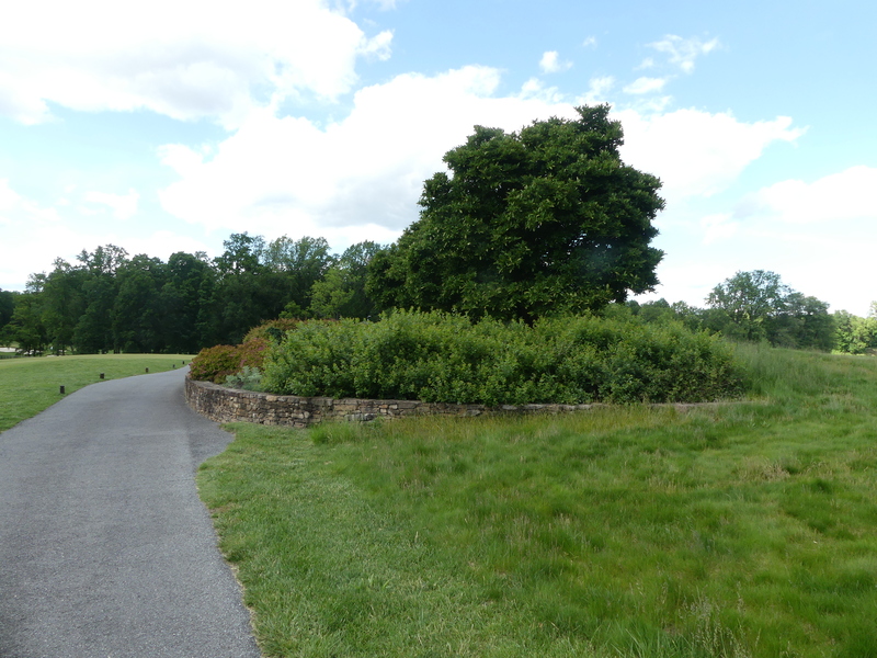
Hole #3 right side up by the green - the stonework encircles the plantings and is adjacent to the cart path - the cart path and stonework are one obstruction - which includes the plantings inside the stonework.
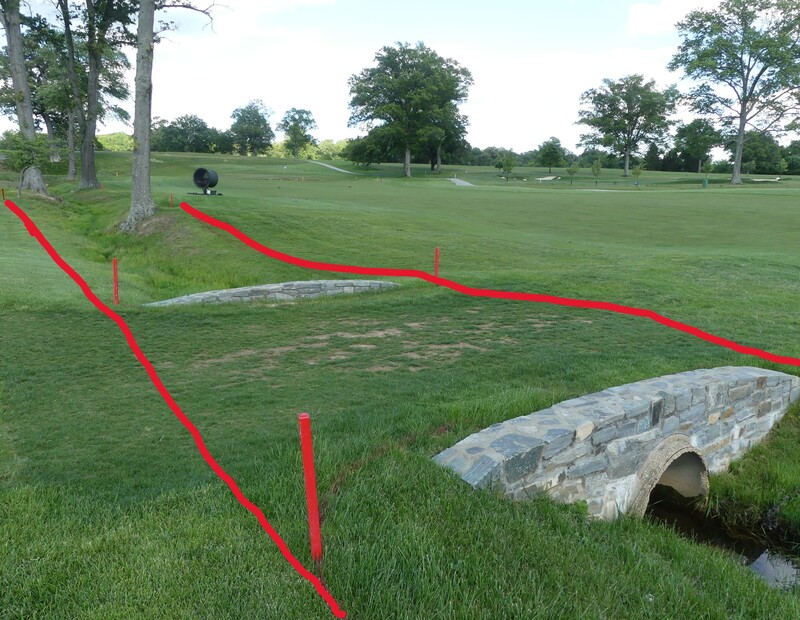
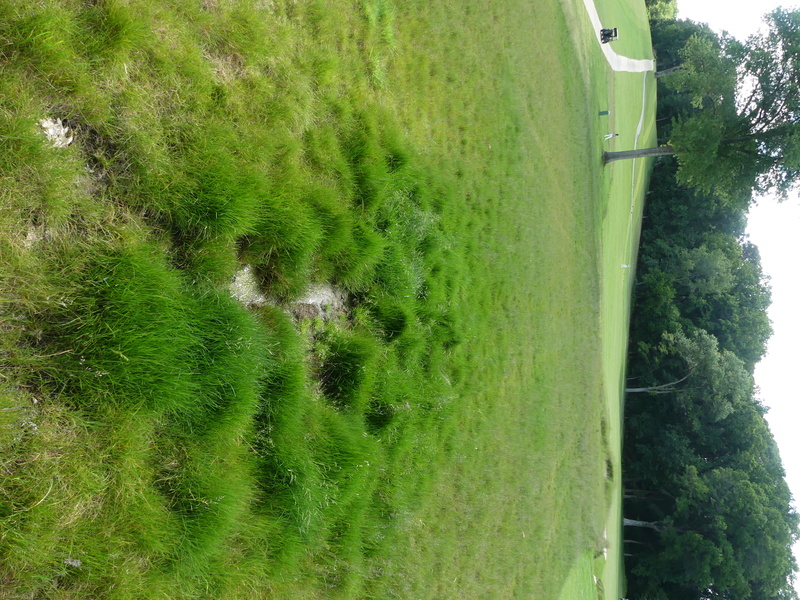
Hole #4 on the right - some areas of tall fescue are getting pretty thick and finding a ball could be a challenge. On #4, up towards the green, there is this mushy spot (which might be a spring) where a ball could easily plug and be lost forever. Unless you are standing there and see the ball land, no way to be virtually certain that the ball is lost in the temporary water that is there. Some players may try to drive this green. This area will not be marked GUR.
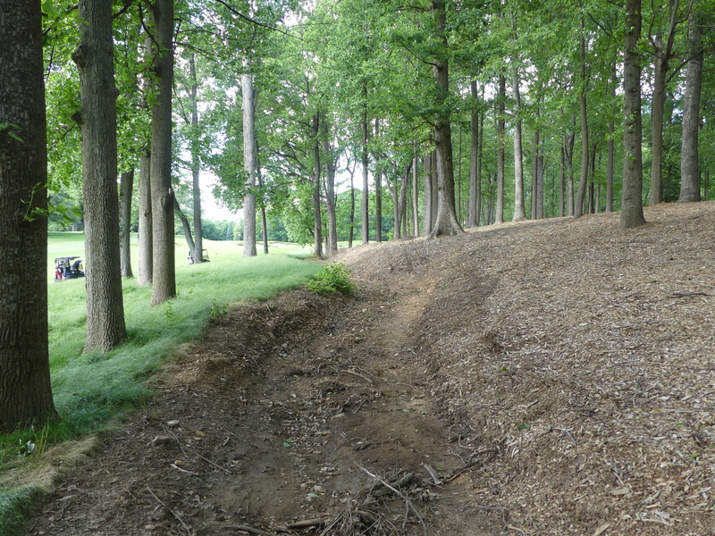
Hole #5, to the right and short of the lake. This was a dirt trail, but it has been surfaced with blue chip stone. Players will be driving almost 100 yards beyond and left of this point. This trail is an integral part of the course, from which there is no free relief.
Hole #5 - where did the ball cross?

Hole #6 to the right, the stonewall and cart path are one immovable obstruction. The stonewall does not encircle the plantings - the plantings are not within the margin of the IO so there is no free relief from the plantings.
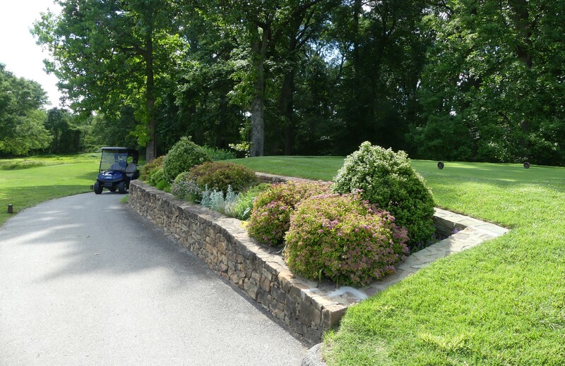
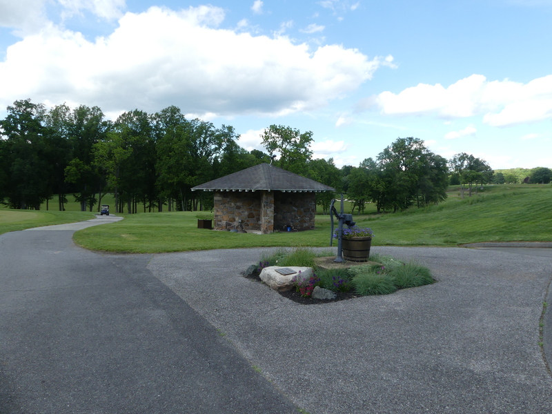
Beyond the initial stonewall there is this large, paved area. The planting and pump handle in the middle of the paved area is part of the IO. The stone shelter beyond is a separate IO and includes the stone covering the ground around the shelter.
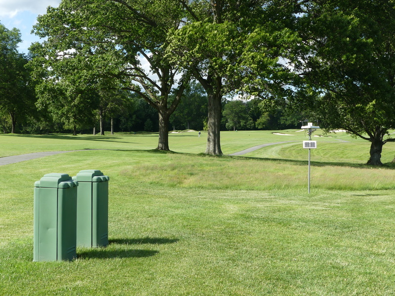
Hole #10 right of drive zone - The weather station is NOT a TIO. Two irrigation boxes close together are treated as one obstruction.
Hole #11, right side fairway bunker - the grass on the outer side of the bunker is really growing and very thick. The tall fescue is more prominent this year than last.
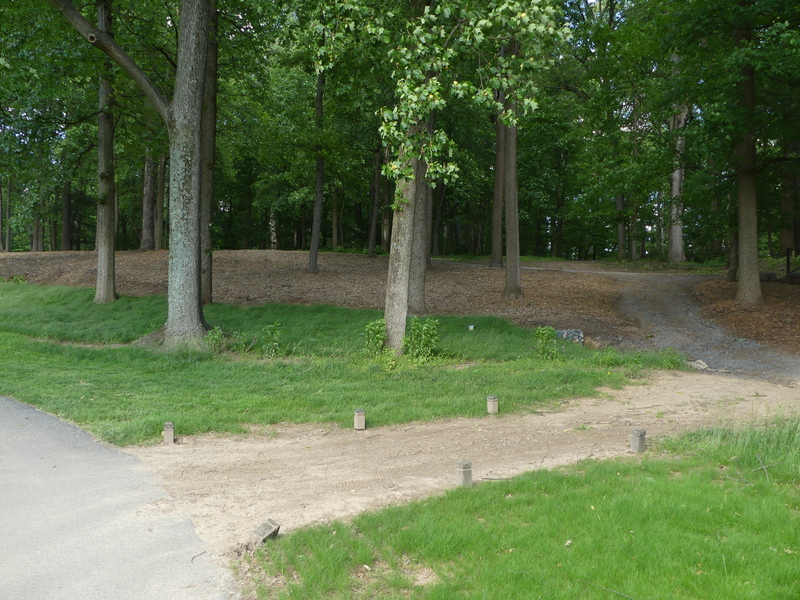
Hole #12 - up the right side - lots going on here. The woods to the right have been cleared out and a lot of that area has been covered in wood chips. There is drainage ditch that runs through this area from behind #13 tee all the way down to just right of the drive zone. There is a worn area/work path that runs from the cart path to the edge of the RPA which is now marked as GUR.
UPDATE - Sunday afternoon: The entire right side of #12 starting about 50 yds before he dog-leg and running up to and behind #13 tee, has been marked as an RPA = the red line (indicated by red stakes) runs right along the edge of the tall fescue, ensuring that a ball that comes to rest in a sod seam will gain relief. 99.5% of the sod along there is in the General Area.
Also on hole #12, way, way right, the course side of the white line on the course side of the club entry road will serve as the OB boundary, and the road is a boundary object - please let me know if anyone hits one over there.
Here is the view from the new tee on #12 - was 420, is now 445. Wonder if anyone will try and drive over the corner? It is a very long way. Keep an eye out for ball searches in there.
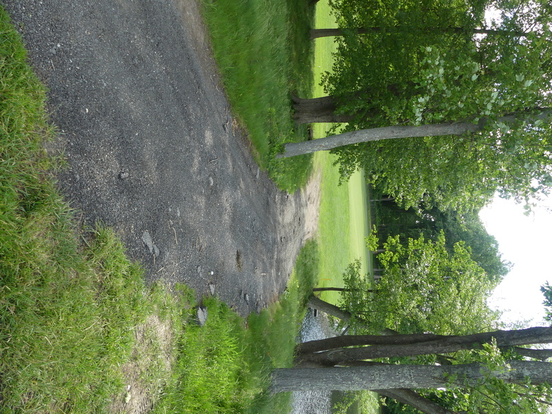
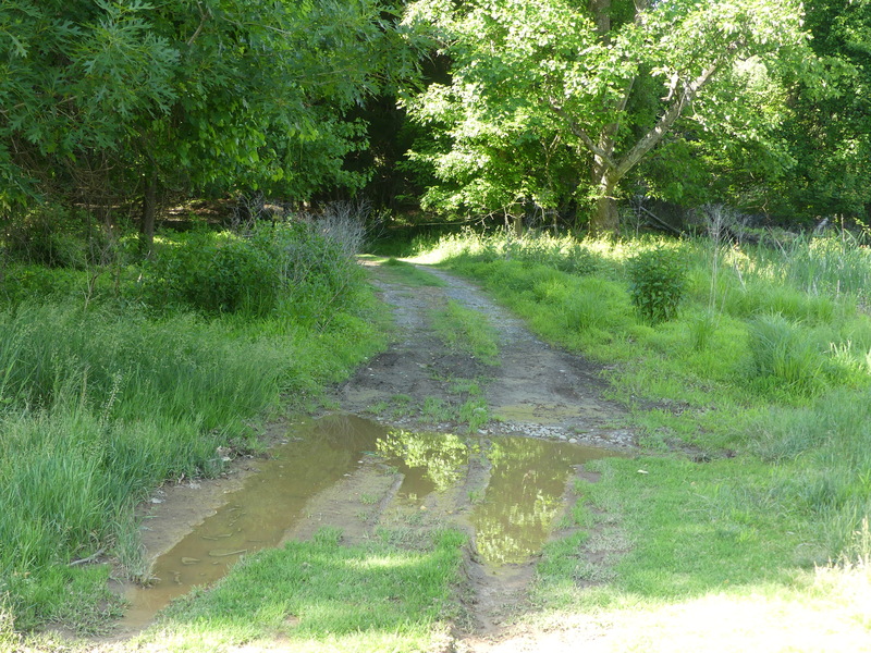
Hole #14, off to the right beyond the drive zone. This old trail, with some gravel surface, is very far out of play and is an integral part of the course. Of course, the puddles are temporary water.
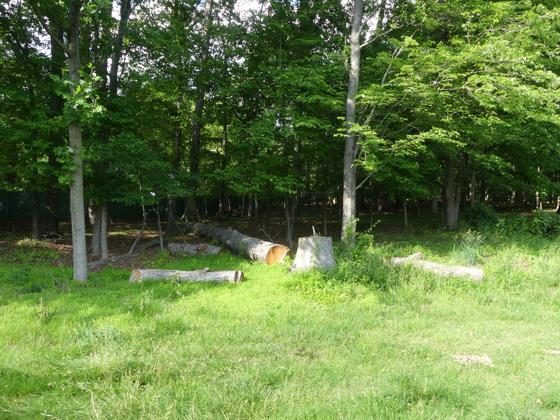
Hole #15 right side across cart path - the fallen tree and its pieces are NOT debris piled for removal. On the left of #15, in the penalty area, which is between #15 and #16, there is some clearing and sodding going on. No relief from any of that mess in the penalty area. Heck, player might even find his ball and have a clean shot!
Between holes #15 and #17 is this bridge/causeway.
All of it lies within the RPA.