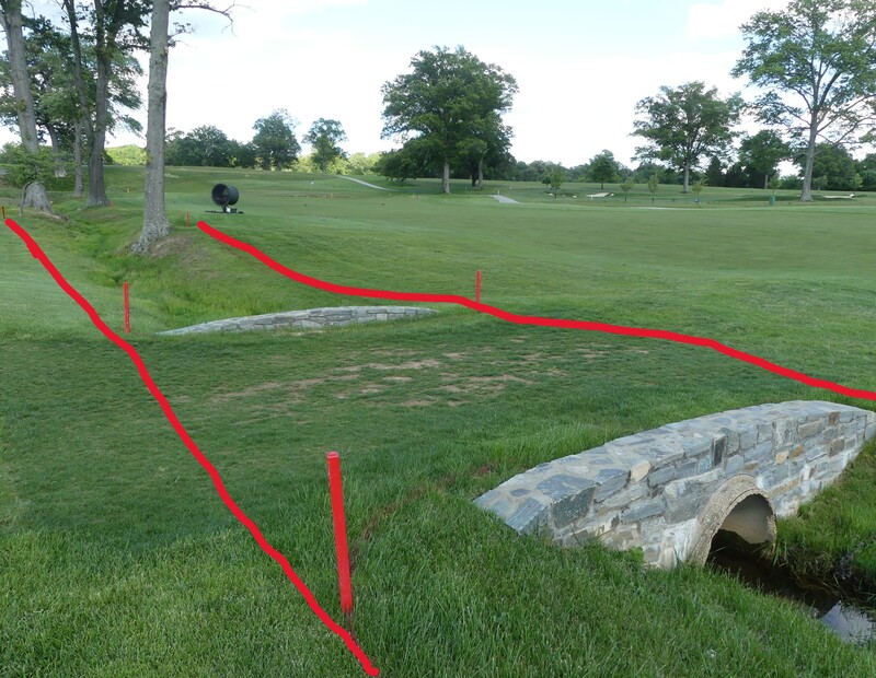
Check the pics out - Note that there are no TIO's at Woodmont for this qualifier.
Tree that is staked and braced - relief from stakes and bracing wires only. There are a handful of these remaining on the golf course.

Mesh covering to protect the tree from deer chewing on the bark is part of the tree and there is no free relief.

Robot Mower charging stations - are immovable obstructions. Included is the tracking wire that guides the robot home to its nest. When the charging station and a water control box are within one club length of each other treat them as one obstruction.
Left of #1 fairway.
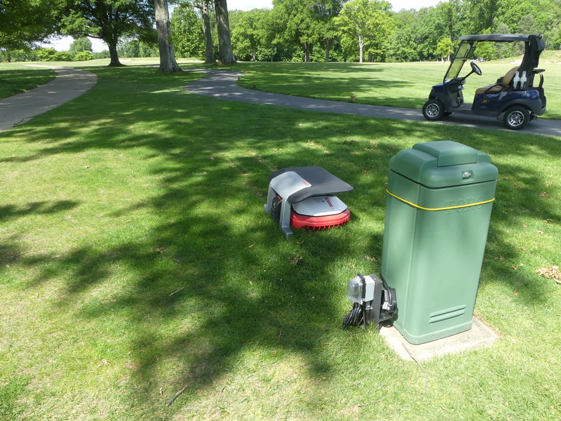
Left of #6 fairway and short of the putting green - note the tracking wire leading into the nest. The station and water box are one obstruction as they are within one club length of each other.
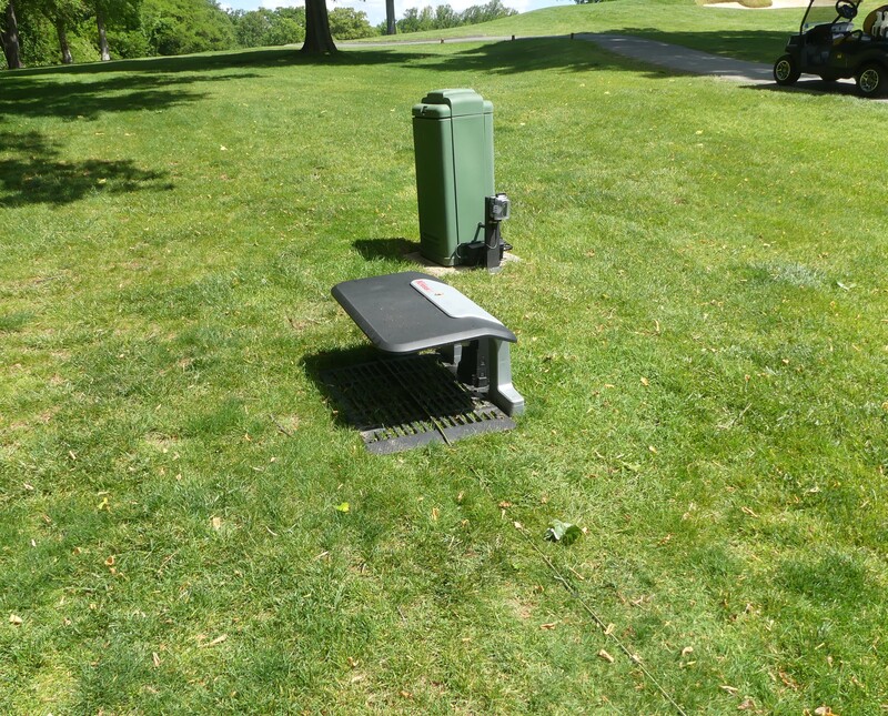
Right of #17 fairway/drive zone - across the cart path. The station and water box are one obstruction as they are within one club length of each other. You can clearly see the tracking wire.
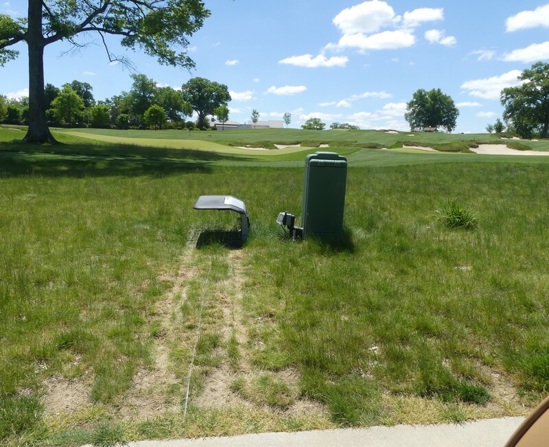
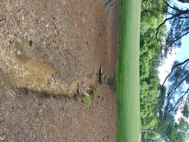
Hole #3 in left rough just short of the drive zone - this eroded area will be marked as GUR. It is deeper than it looks!
UPDATE - an effort has been made to remediate this bad area. It has been filled and covered with a thick layer of pine straw. Unless heavy rain washes it out, it will not be marked GUR. To the left of the cart path in this area, there is a sizable area marker GUR that is healing in from work vehicles used to make the bigger repair.
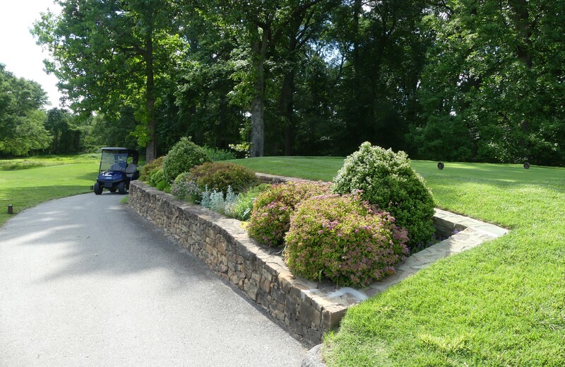
Hole #3 right side up by the green - the stonework encircles the plantings and is adjacent to the cart path - the cart path and stonework are one obstruction - which includes the plantings inside the stonework.
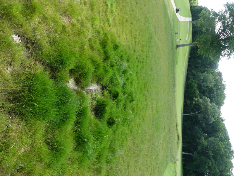
Hole #4 on the right - some areas of tall fescue are getting pretty thick and finding a ball could be a challenge. On #4, up towards the green, there is this mushy spot (which might be a spring) where a ball could easily plug and be lost forever. Unless you are standing there and see the ball land, no way to be virtually certain that the ball is lost in the temporary water that might be there. Some players may try to drive this green. This area will not be marked GUR.
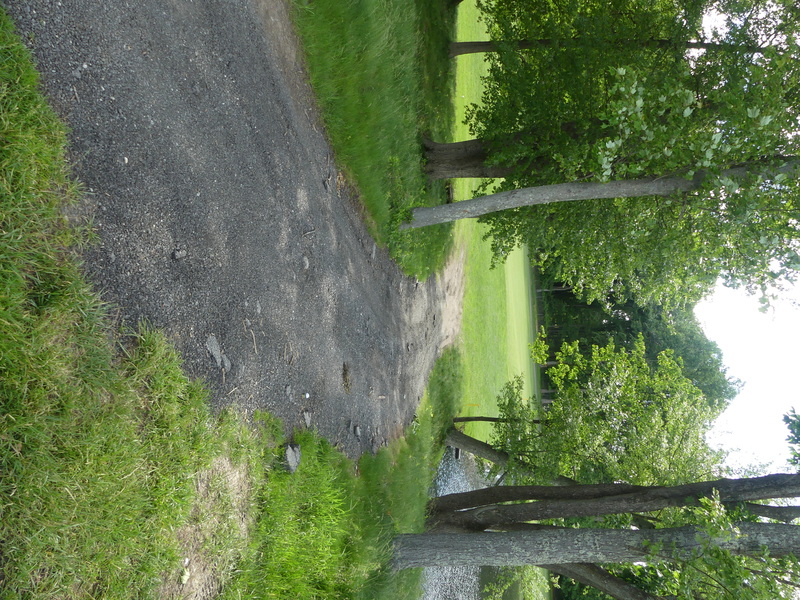
Hole #5, to the right and short of the lake. This was a dirt trail, but it has been surfaced with blue chip stone. Players will be driving almost 100 yards beyond and left of this point. This trail is an integral part of the course, from which there is no free relief.
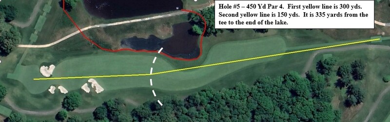
Hole #5 - where did the ball cross?
Hole #5 is being played as a par 4 of 450 yds. It is 270 to carry to the fairway at the bend where it widens out. The first yellow line/white dashed line shows a 300-yard drive. The second yellow line is a second shot of 150 to the center of the putting green. Most will drive it past the 300-yard point. It is 365 to the first bunker on the left.
The lake, app. 40 yards of gunch grass beyond the lake, and the entire wilderness area right of the lake is a red penalty area.
The RPA begins way to the right (see diagram), comes down through the trees, along the perimeter of the lake, up along the app. 40 yds. of gunch grass, and then swings way right towards hole no. 9.
If the wind is in the player’s face it will be far more interesting. I am hoping for a decent wind – say 10 or 15 MPH – 20 would be really fun!
The carry from the tee to the end of the pond is 335 yards. If it’s downwind, and a player blocks it or hits a big cut (righty) or a draw (lefty), and the ball carries the pond, it will be in the penalty area and likely lost. It is possible that the ball could cross the red line way up at the end of the pond near the high grass, permitting a very favorable drop, but determining that could be problematic. If the player sees it splash, the odds are the ball crossed the red line well back, and not up by the landing area. Could be an interesting ruling if it happens.
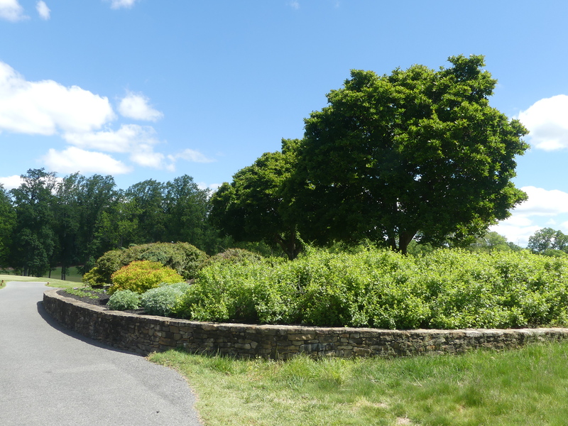
Hole #6 to the right, the stonewall and cart path are one immovable obstruction. The stonewall does not encircle the plantings - the plantings are not within the margin of the IO so there is no free relief from the plantings.
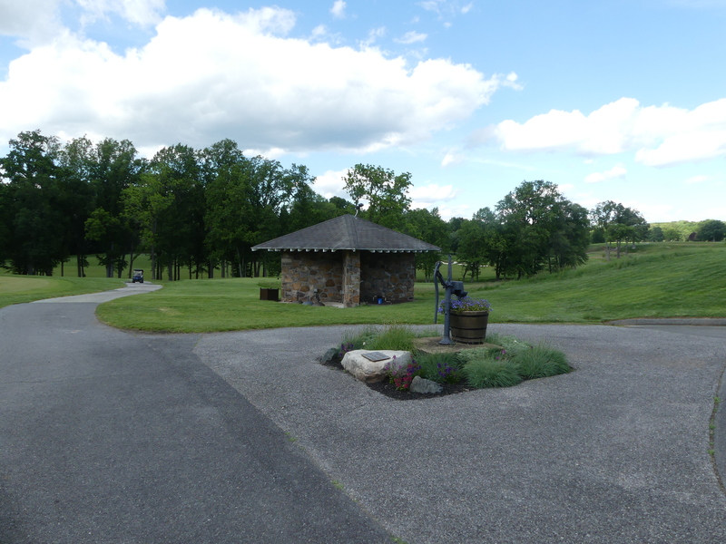
Beyond the initial stonewall there is this large, paved area. The planting and pump handle in the middle of the paved area is part of the IO. The stone shelter beyond is a separate IO and includes the stone covering the ground around the shelter.
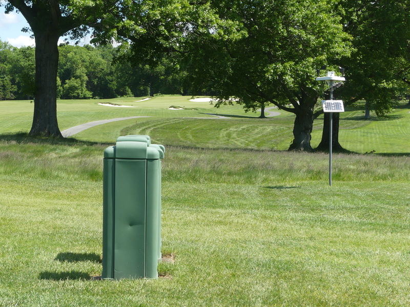
Hole #10 right of drive zone - The weather station is NOT a TIO. Two irrigation boxes close together (within one club length of each other) are treated as one obstruction. They do get whacked!
Hole #12 - up the right side - The entire right side of #12 starting about 50 yds before the dog-leg and running up to and behind #13 tee, is an RPA. The red line (indicated by red stakes) runs right along the edge of the tall fescue.
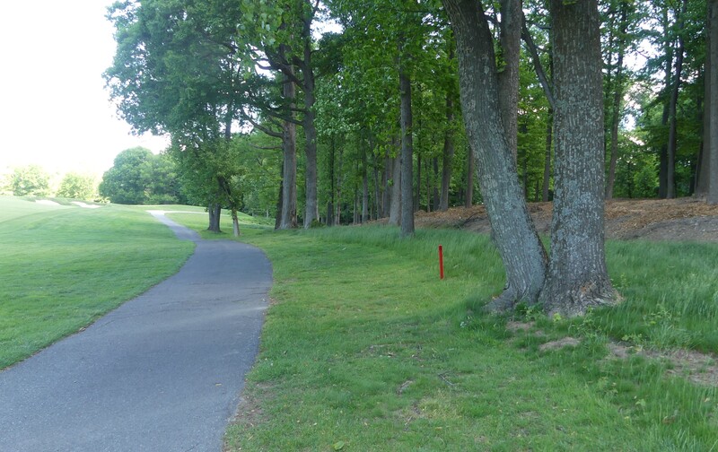
Also on hole #12, way, way right, the course side of the white line on the course side of the club entry road will serve as the OB boundary, and the road is a boundary object - please let me know if anyone hits one over there.
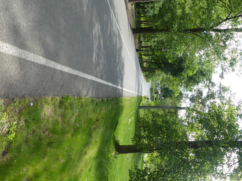
Here is the view from the new back tee on #12 - was 420, is now 445. Wonder if anyone will try and drive over the corner? It is a very long way. Keep an eye out for ball searches in there.
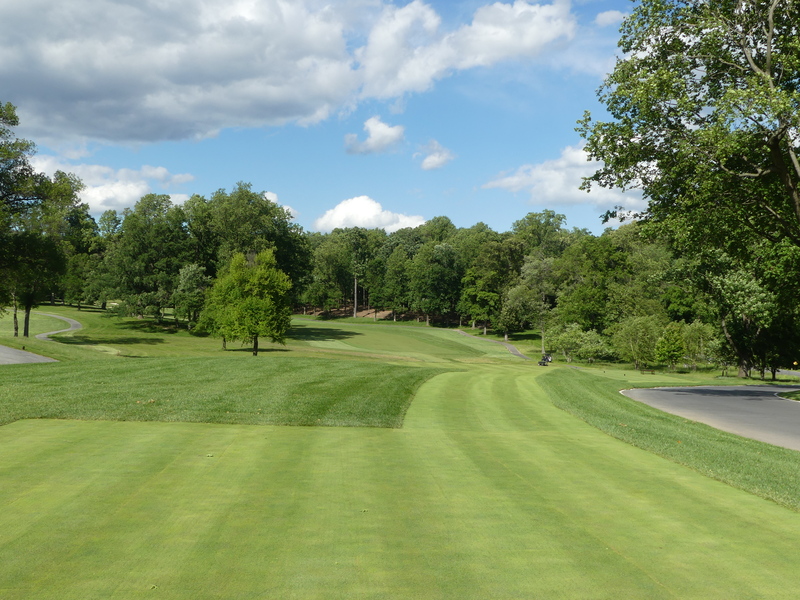
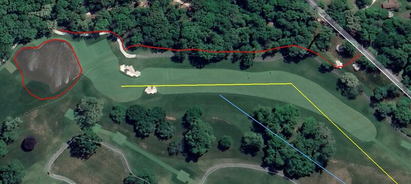
Arial shot of #12 - 445 yards - the red penalty area begins on the right a bit short of the drive zone. It is marked primarily with a red line (and red stakes to ID the line) and at the start of the RPA, just stakes (in the fescue area to the right before the primary tree line). There is a work trail comprised of stones (black line) that crosses into the RPA. As it is in the RPA, no relief. Note that the penalty area beyond the putting green is now all red - no more yellow up there.
The bold yellow lines represent a tee shot of 280 yards - typically a fairway wood or driving iron for our players - followed by an uphill second shot of app. 165/170 yards - 7 or 8 iron. The pale blue line is 320 from the tee, the distance needed to clear the trees and gunch grass on the left corner. It needs to carry at least 300 with a very high arc to clear those trees - a sucker play. Last year there were quite a few ball searches in there, so keep an eye peeled!
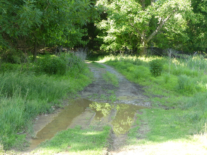
Hole #14, off to the right beyond the drive zone. This old trail, with some gravel surface, is very far out of play and is an integral part of the course. Of course, the puddles are temporary water.
Between holes #15 and #17 is this bridge/causeway.
All of it lies within the RPA.